What’s in the TMDL
The heart of the Lake Champlain TMDL includes limits for the amount of phosphorus that can enter the lake and the percentage of reductions that are necessary to hit these limits. It breaks down these limits by a couple of different categories. This results in a complex set of pollution reduction requirements for Lake Champlain.
First, the TMDL breaks the limits down by the land use, or source, of pollution. Some of these categories are broken down into subsets, but essentially, they are developed areas, agriculture, forest, streambanks, and wastewater treatment facilities.
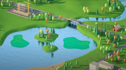
Second, because the conditions in and around different parts of the lake vary greatly, different parts of the lake have different phosphorus limits. Different soils, geology, topography and other physical and chemical aspects of the landscapes, combined with varying depths, extents, and circulation patterns within the lake make for a very complex system. It is too complex to be treated the same throughout. So the Vermont TMDL assigns limits specific to 12 different lake segments.
Overall, the Vermont portion of the Lake Champlain basin needs to reduce phosphorus inputs by 34% or 213 metric tons per year. One metric ton equals 2,204 pounds, or roughly the equivalent of one of the smaller cars on the road today. The lake segment that requires the greatest reduction (about 64%) is Missisquoi Bay in the northeastern part of the Lake. The segment near Isle La Motte requires the least reduction (about 11.5%).

Complex conditions mean complex solutions.
The phosphorus limit for Missisquoi Bay is more than twice as high as the limit for Malletts Bay and the reduction needed to meeting water standards is nearly four times as great.
-
What is the TMDL?

-
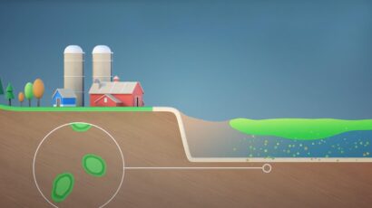
What is Phosphorus?
-
What You Can Do?

-
Best Management Practices

-
Legacy Phosphorus